Turn an Excel spreadsheet into an interactive map
If your locations already live in a spreadsheet, you do not need to place pins one by one. Paste the rows or export and upload CSV, then map the address column and turn every row into a pin.
- Paste rows from Excel or Google Sheets, or export and upload CSV; every row becomes a pin without placing them one by one.
- Addresses are geocoded for you, so you never have to look up latitude and longitude.
- You map your own columns onto the fields of the location card, so your data stays as you keep it.
- Re-upload the CSV or JSON file later to update an existing dataset.
- On Free you publish through a permanent link; embedding and a downloadable Studio QR start on Basic, a custom domain is Premium, and branding removal is Custom.
How it works
- 1
Add your locations
Paste a website, a list or a CSV file, or let the assistant scan a site for you. Every location becomes a pin on the map.
⌘cmdV - 2
Set up the map
Decide what each location card shows: photo, description, opening hours and your own fields. Then pick categories with their own colour and icon, a map style and areas if you need them.
 Papi di PanzaNoorderplantsoen, Groningen🥗 Food & drinksClosedopens 15:00180 m~3 min walk
South Italian panzerotti and cannoli.
FoodstandPondStand 18VegetarianVegan- Takeaway
- Open during the festival area's opening hours
papidipanza.com@papidipanza - 3
Share the map
Publish to a permanent link, put up a QR code, or embed the map on your website from Basic. Changes go live immediately.
Try it now
Paste a website, list or CSV. The Studio assistant creates a real map that you can continue editing after you create an account.
8,328 rows, one file
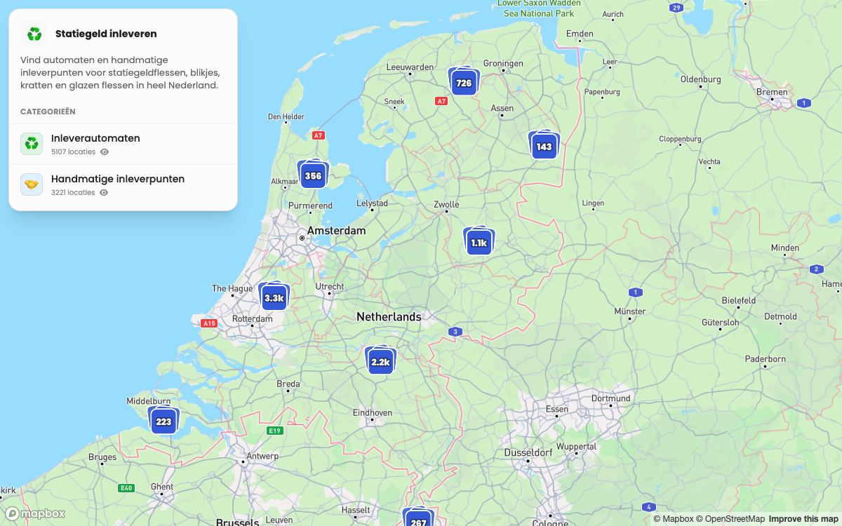
This map was made exactly that way: one file with thousands of addresses, imported in one go. Click into it to see what that produces.
- 8,328 addresses from a single import, split across two categories.
- Points cluster automatically until you zoom into a street.
- Every point has its own description, taken from a column in the file.
- No work per row: the addresses were geocoded for us.
What you get
Once you build a map from your spreadsheet in localthings, this comes with it as standard:
CSV and JSON import
Add a complete dataset in one go.
Configure columns and fields
Choose the title, description and which data visitors see.
Location search
Let visitors find a specific place fast.
Frequently asked questions
Do I need latitude and longitude in my spreadsheet?
No. A street address, postcode and city is enough - the addresses are geocoded during import. If you do already have coordinates, use them: they are more precise than any address lookup.
Which file formats can I upload?
Upload CSV or JSON. If your data lives in Excel or Google Sheets, paste the rows directly or export them as CSV first; direct .xlsx upload is not supported.