localthings as an alternative to ArcGIS Online
ArcGIS Online is a broad cloud GIS for maps, hosted layers, spatial analysis, apps and organisational workflows. localthings is not a replacement for that system. It is the narrower option when the deliverable is a branded public map of locations that visitors can browse.
- Choose ArcGIS Online for hosted geospatial layers, spatial analysis, apps, automation and work across an Esri organisation.
- ArcGIS Online can share and embed public maps, and Esri does not charge for public map views or data transfer.
- Choose localthings when the finished product is one public-facing location map with a list view, categories, visitor filters and rich location cards.
- Both products accept spreadsheet data. localthings imports CSV or pasted Excel rows and publishes a permanent link on Free; embedding starts on Basic.
localthings vs. ArcGIS Online
A factual comparison on the points that matter to most people.
| Feature | localthings | ArcGIS Online |
|---|---|---|
| Public link and website embed | Link on Free, embed from Basic | |
| Public map views without usage charges | ||
| CSV or spreadsheet import | ||
| Configurable colours, symbols and pop-ups | ||
| Visitor filters, list view and location cards | Configured through maps and apps | |
| Spatial analysis and geoprocessing | ||
| Authoritative data layers and coordinate systems | ||
| Apps, dashboards and automated GIS workflows | ||
| Commercial billing model | Per published map | Annual user licences plus usage credits |
When ArcGIS Online is the right call
Choose ArcGIS Online when you need spatial analysis, authoritative or hosted data layers, coordinate-system handling, multiple map-based apps, automation, or integration with a wider Esri stack. localthings does not replace those workflows.
When localthings fits better
Choose localthings when the map itself is the public product: a branch finder, venue map, local guide or facilities map with your branding, a list view, categories, filters and detailed location cards. The builder stays focused on that publishing workflow.
A public map is the whole deliverable
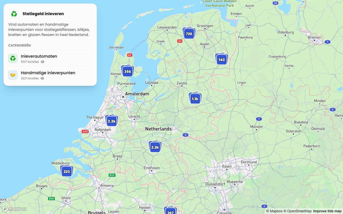
This published localthings map turns 8,328 imported addresses into a map and list that visitors can browse by category. It demonstrates the focused public experience described on this page, not GIS analysis.
- 8,328 addresses, split across two visitor-facing categories.
- Points cluster automatically until the visitor zooms into a street.
- Every location opens its own description from the imported data.
- The same public link stays current when the map data changes.
Frequently asked questions
Is localthings a GIS?
No, and it does not claim to be. There is no spatial analysis, no geoprocessing and no coordinate-system management. It is a builder for publishing a branded, interactive map of your locations.
We already have ArcGIS. Is there a reason to add this?
Sometimes. A team can keep its source data and GIS work in ArcGIS, export the public location rows to CSV, and use localthings for a separate visitor-facing map. That only makes sense when the simpler public experience is worth maintaining a second product.
Can I import a shapefile?
Not directly. Export the attributes to CSV with an address or coordinates per row and import that. Areas are drawn in the builder instead of imported.
Can ArcGIS Online publish and embed a public map?
Yes. ArcGIS Online supports public links and ready-to-use embed code. Esri states that public map views and data transfer do not incur usage charges, although authoring requires the relevant organisation account and some storage, geocoding and analysis operations consume credits.
What does localthings cost?
Free includes one map with up to 100 visible locations and a permanent link. Embedding starts on Basic; a custom domain and analytics are Premium; branding removal is Custom.
Also worth a look
vs. MapPoint
The web replacement for one MapPoint job: a shareable map from a spreadsheet.