A Maptive alternative for public-facing maps
Maptive and localthings both turn spreadsheet data into styled maps that you can share or embed. The difference is scope. Maptive adds territory planning, route optimisation, heat maps and demographic analysis. localthings stays focused on publishing a branded map that customers, visitors or residents can browse.
- Choose Maptive when you need territory planning, routes, heat maps, demographic data or large-scale location analysis.
- Choose localthings when the finished product is a branded public map with categories, visitor filters and detailed location cards.
- Both products work with spreadsheet data, style markers and publish maps by link or embed. In localthings you import CSV or paste rows from Excel.
- localthings has an ongoing free plan for one map and up to 100 locations; Maptive offers a 10-day trial before paid access.
localthings vs. Maptive
A factual comparison on the points that matter to most people.
| Feature | localthings | Maptive |
|---|---|---|
| Ongoing free plan | 10-day trial | |
| No code required | ||
| CSV import or paste from Excel | ||
| Public link and website embed | Link on Free, embed from Basic | |
| Custom colours, markers and logo images | ||
| Location details with photos and links | ||
| Visitor filters on a shared map | ||
| Route optimisation and territory planning | ||
| Heat maps and demographic analysis | ||
| Billing model | Per published map | By users and data capacity |
When Maptive is the right call
Pick Maptive when analysis is the job: balancing territories, optimising routes, building heat maps, using demographic layers or working with very large datasets. Maptive can publish public maps too, but its broader toolset earns its keep when your team uses those analysis features.
When localthings fits better
Pick localthings when the public map itself is the deliverable: a place directory, event map, facilities map or local guide in your own branding. You get a map, list view, categories, visitor filters and detailed location cards without paying for route or territory analysis you will not use.
The published map is the product
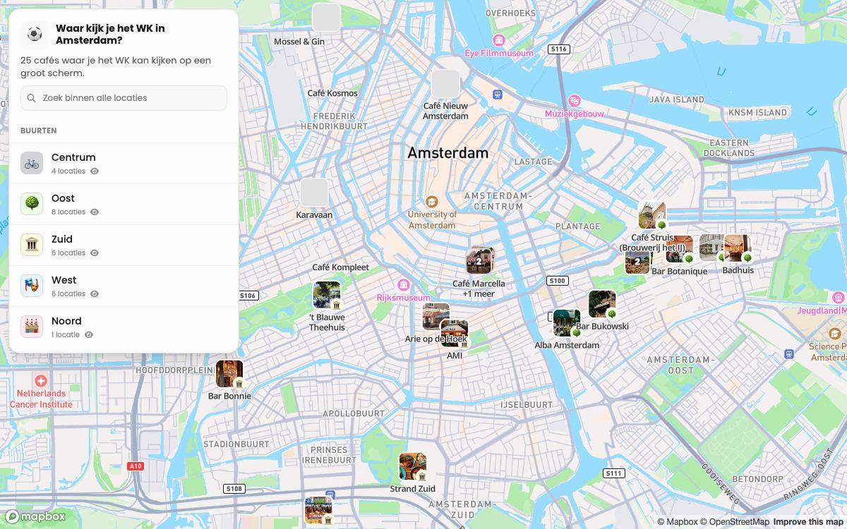
This localthings map gives visitors 25 Amsterdam cafés to browse. Photos, descriptions and district filters are part of the public experience, not an analysis workspace behind it.
- 25 cafés, each with its own photo and description.
- Grouped by district, which is what the visitor filters on.
- Works on a phone without an app or account.
- One public link that stays current when the owner edits the map.
Frequently asked questions
Is localthings a like-for-like replacement for Maptive?
No. Both products import and publish location data, but Maptive has a much broader analysis toolset. localthings does not replace its route optimisation, territory planning, heat maps or demographic layers. It is the closer fit when you need a polished public map rather than a full location-analysis suite.
Can both products publish a map on my website?
Yes. localthings publishes a public link on Free and generates embed code from Basic. Both products let you style markers and show location details; Maptive adds the wider analysis toolset.
Can I move location data from Maptive to localthings?
Yes. Export the relevant rows from Maptive as CSV and import that file into localthings, or paste rows from Excel. Your source columns become fields on the location cards; categories, styling and visitor filters are configured afterwards.
What does localthings cost?
Free includes one map with up to 100 visible locations and a permanent link. Embedding starts on Basic; a custom domain and analytics are Premium; branding removal is Custom.
Also worth a look
vs. MapPoint
The web replacement for one MapPoint job: a shareable map from a spreadsheet.